Saturday, January 21, 2012

Snow Event Summary and Forecast

After a very neat snowstorm yesterday and last night, I would like to give a summary of the storm system.  This system developed from a strong wave of North Pacific low pressure systems that have been pounding the West for days on end.  Here is an analysis image of the jet stream configuration on Wednesday, January 18, 2012.  As you can see in the analysis, an incredibly strong polar jet stream is making its way from the North Pacific to the United States, with the jet streak itself containing winds of almost 200 mph or 180 knots.  This jet streak is what produced the first clipper system that brought 1-2 inches of snow to the area (officially it brought 2 inches of snow to Fort Wayne.).  As the day progressed Wednesday, subtropical moisture from the subtropical jet stream was pouring into the Pacific Northwest, creating heavy snowfall, heavy icing and heavy rain, along with high winds and thunderstorms to some areas.  Seattle during this time frame had record amounts of snowfall.  Below is an image of the 700 millibar relative humidity values on Wednesday.  As you can see, there was plenty of moisture with the system in the Northwest.
By early Thursday morning, a shortwave, along with low level frontogenesis generated an area of light to moderate snow over Iowa, Illinois and Indiana, which eventually spread over the area by late morning.  That night, the clipper system that brought the snow, pushed a strong cold front through the area, causing temperatures to drop down to 2 degrees by the early morning hours of Friday.  Here is an analysis image of the 850 millibar level Friday morning.
Again, you can see that there was a strong baroclinic zone (note: a baroclinic zone is an area in which temperatures vary drastically, which can lead to the development to the develop of a major storm system if conditions are right.  Temperatures on this map are in degrees Celsius) which was draped across the Midwest.  This baroclinic zone lead to the development of this 850 millibar low, located over the lee side of the Rocky Mountains, causing an intensification of heavy snow over Iowa and Illinois, later spreading eastward into Indiana, Ohio, and Michigan by mid afternoon.  As you can see warm moist flow from the Gulf of Mexico over the very cold surface air was causing heavy snow to break out over the Great Lakes and Ohio Valley.  Frontogenesis is the intensification of a baroclinic zone, which causes strong upward motion and the intensification of bands of precipitation.  These two maps below show that strong frontogenesis was occuring over the main heavy snow area over Illinois, Iowa, and Wisconsin, with frontogenesis also occuring over the Ohio Valley as well.


This also caused the intensification of heavy snow bands, leading to widespread amounts of over 8 inches in Iowa and Illinois.  The storm headed eastward by late Friday afternoon, intensifiying at the same time, but also causing snow to change over to sleet and freezing rain in Southern Indiana.  After that, heavy bands of snow moved through Northeast Indiana and Northwest Ohio, causing near whiteout conditions at times.  By 8:00 p.m. last night, increased frontogenesis and uplift caused even heavier bands of snow to develop but they were developing near Indianapolis.  Surprisingly, even though radar indicated heavy snow south of here, our snowfall was coming down just as heavily, because they had larger flakes of wet heavy snow, rather than small, dry flakes of snow.  This still allowed the heaviest snowfall totals to fall from Fort Wayne to Paulding, with a general 4-7 inches falling in these areas.  Snow tapered off over the entire area by 3:00 a.m. last night, leaving many areas with over 6 inches on the ground.  Officially, in Antwerp, I have recorded an average of 6 inches, with some drifts deeper than that.  In Fort Wayne, official snow totals from yesterday was 3.8 inches (before midnight), with probably an additional inch or two falling after midnight.  This brings Fort Wayne's seasonal snowfall total to exactly 24 inches, which is 7 inches above normal for this time of year.  Surprisingly enough, you may have thought this winter was relatively snowless in the area, but we have actually had more snowfall than last year's snowfall total by this time, and we thought last year was really snowy!  The monthly snowfall for January 2012 is 12 inches which is 5 inches above normal.  With the long-range looking like it is right now, we may see at least one more snowstorm before the month of January ends. 
As for the forecast for the next three days, expect much below normal temperatures today, with highs in the low 20's and upper 10's.  By tonight, strong warm air advection will take place aloft, caused by another strong storm system moving out of the Rockies.  As warm air rides up and over the arctic air at the surface, expect an increase in clouds and possibly freezing drizzle tomorrow morning.  Warm air will then begin mixing down to the surface, causing temperatures to rise.  This warming will be strongly offset by cooling with the frigid ground, which will only allow the warm up to cause temperatures to climb into the mid and upper 30's.  By Sunday, significant cyclogenesis will occur with a strong cyclone in the plains states, causing an intensification of the low level jet stream, which will pump warm, moist air into the region.  On the nose of the LLJ (low level jet), widespread heavy rain and thunderstorms will develop late Sunday Night, with the possibility of a QLCS squall line moving through with strong winds and possibly a tornado (right now the threat for severe weather is low, but there is that little chance that conditions will come together just right to form a major severe weather event.).  Heavy rain, combined with rapid melting of the snow cover, will allow for the possibility of widespread flooding to take place across the area.  By later Monday afternoon, temperatures will drop drastically behind the cold front, but they will not be as cold as it was last week.  Continue to read my updates for further forecasts.


Thursday, January 19, 2012

Snowfall Update and Forecast.

After a very fluffy and snowy morning commute, many of you may be wondering what will happen with this next snow event.  The local TV weatherman may be passing this next event off as insignificant, but recent model forecasts and analysis indicate otherwise.  As I mentioned yesterday, if the ingredients come together just right, we may be in for a significant snowfall Friday afternoon into Saturday morning.  Right now, I'll start with what's going on.  A moderately sized Alberta Clipper is now moving from northern Michigan into Canada, which is what caused the snow earlier today.  As it moves away, the clouds should clear somewhat, as drier air makes its way into the area.  Areas south of U.S. 30 will continue to see light to moderate snow through the rest of the afternoon. Tonight, I am expecting clouds to continue clearing, giving way to clear skies by evening after lake effect diminishes.  This will allow temperatures to drop below 10 degrees tonight, some areas will drop to about 5 or 6 degrees, with even colder wind chills.  By the very early morning hours, cloud cover will increase ahead of the next storm system.  This system will be a quick, but strong, disturbance, originating out of the same storm train that brought Seattle a record-breaking snowstorm, and is still bringing a large part of the west heavy snow, heavy rain, heavy icing, and high winds.  This system will quickly move out of the Rockies and into the Midwest tomorrow morning, and with the limited moisture that it has, will cause moderate snow to break out over Nebraska and Iowa.  If the storm would not change its characteristics, we would probably see snowfall amounts on the order of 1-3 inches, instead of the amount I am forecasting.  When this relatively weak surface low (at the time) moves into the Midwest, it should begin picking up moisture from the Gulf of Mexico.  At the same very strong isentropic lifting will occur over our area, causing widespread snow to develop ahead of the system (note: an isentrope is a line of equal potential temperature, which is the temperature an air parcel will have if raised or lowered to the 1000 millibar level.  When air flows upward on these isentropes, it causes vertical motion and clouds and precipitation will form if it is fairly saturated.).  Other features, such as strong frontogenetical forcing at the surface, could possibly cause mesobanding of heavy snow, leading to the possibility of high snowfall rates (1-3 inches per hour snowfall) for several hours Friday night.  Forecast soundings that I have looked at have shown me that temperatures will remain below freezing throughout the entire atmosphere above us Friday night, leading me to forecast not much in the way of sleet and freezing rain.  But, the forecast NAM sounding for 11 p.m. Friday night is showing temperatures at the 850 millibar becoming very close to freezing point, which means there is the possibility that some areas, especially south Fort Wayne and Paulding, could see some sleet mix in. Other than that, most areas will see heavy snowfall Friday night.  By early Saturday morning, snow will end across the area, probably around 4 a.m.. Right now, the latest short range computer models are pointing to the heaviest area of snow remaining just to the west, near Chicago, but we could also be in this band of heaviest snowfall.  Right now, my forecast has the potential for 4-8 inches of snow to fall (which is close to the what the National Weather Service is predicting, 3-7 inches).  The 12z GFS has some isolated areas in Northwest Ohio and Northeast Indiana to receive over 8 inches of snow, depending on how much mesoscale banding of snow takes place.  If more sleet mixes in than expected, than those areas will probably see 2-5 inches of snow, especially south of a line from Paulding to Fort Wayne.  If more moisture is available, strong isentropic upglide, along with stronger frontogenetical forcing, I would definitely expect much higher snowfall totals.
   As for the warm up next week, it really won't be that big of a deal.  Temperatures will likely reach the upper 30's and lower 40's by Sunday and Monday, with another strong storm system returning.  This strong storm system could very heavy rain, and a severe weather potential to our area, with the possibility of a QLCS squall line forming and racing through the area.  This combined with rapid snowmelt and rainfall over an inch could cause some flooding to occur in many areas.  This is the potential we have to watch out for next week.

Wednesday, January 18, 2012

Snowfall Potential Next Three Days

Some exciting news yet again.  For all you snow lovers out there, another snow event is on the way, and if conditions all come together correctly, then expect some significant snow amounts.  This discussion will be very brief for the time being, but I will give a few details.  First off, two storm systems will be moving that will both bring the potential for accumulating snowfall.  Second of all, these storm systems are originating from a very strong train of storms coming into the Pacific Northwest on the nose of a very powerful jet stream with winds of over 190 knots (219 mph!).  This combined with cold surface air will create the potential for snowfall tomorrow morning and once again on Friday.  Here's what I am expecting at this time.  Tomorrow's snowfall will likely be in the range of 1-2 inches at most, mainly because this next storm isn't very strong and is doesn't have a whole lot of moisture to work with.  For Friday's system, I am expecting much more significant snowfall amounts, with possibility of more than several inches to accumulate.

Monday, January 16, 2012

Pattern change update!

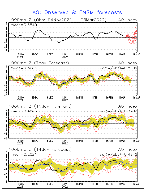
Many meteorologists have already given up on the fact of a pattern change, especially as most long-range ensemble forecasts offered little hope this week for sustained cold in the U.S. through the 25th of January.  But an interesting piece has come up, that may be our last hope for a major reversal into a winter like last year.  According to the latest Climate Prediction Center ensembles, the Arctic Oscillation is expected to take a major nosedive to near record low values (-4 to -5).  This would cause a second major weakening of the polar vortex, allowing brutal arctic to drain out of the arctic.  This major nosedive is expected to happen now, and in the next several days, and really bottom out by the 25th of January.  Right now, this could be our last major hope for a recovery of below normal temperatures for long periods of time and snowy conditions.  The sad thing is is that most of the long range operational models are not showing any kind of long term cold in the next two weeks.  But if the arctic oscillation were to go as strongly negative as it is expected to, than expect some major cold (and of course snow) in about a week or so.  Before that happens, operational models are expecting a major warm up into the lower and middle 50's by Sunday of next week, before a potentially a very strong arctic cold front, along with a strong low pressure system pulls extremely cold air out of the depths of Alaska, which is currently where the coldest air in the Northern Hemisphere.  This is good news, because if Alaska had not been cold this winter, we wouldn't have had any type of snow or snow event so far this winter, and since the cold air in Alaska will keep building right through February, expect more sustained arctic outbreaks and snow events.