After listing off my reasons for the winter forecast, I will give a month by month outlook on what will likely happen this winter, including region-by-region forecasts. In general, wet and below normal temperatures will be persistent across the northern United States, while the South and Southwest will bask in sunshine for large parts of the winter, allowing for the Texas drought to re-expand. Across the Northeast and Mid-Atlantic states, I expect them to start off with below normal temperatures and frequent snowfall, but by late January and February, I expect a major warming trend, while the storm track remains over the Ohio Valley. In the Central Plains, I expect that frequent bouts of cold will hit the region, but precipitation and snowfall will be near to slightly above normal. Now for the details.
(Disclaimer : This forecast is subject to change and it could change drastically. Do not use this as a guide to the winter, as it may be wrong and you may solely be disappointed.)
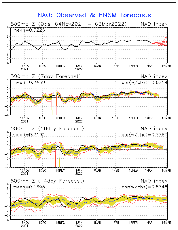
November: I want to start out with the month of November, mainly because I think that unlike last year, this year's winter may start out by mid-November. November is looking a bit iffy for a forecast, but it looks like below normal temperatures will prevail across a good chunk of the United States, as the NAO goes negative by early to mid November. Many regions especially across the North Central Plains will likely see a couple of snowstorms during this time, while other parts of the Great Lakes and Ohio Valley will likely see the start of the Lake-effect season, especially after mid-November. There may even be some synoptic scale storm systems that bring accumulating snowfall to the Ohio Valley during this time as well. In the Northeast, this may be the perfect time for a Nor-easter to form, even though it will likely not be a snowstorm. Across the Southern United States, I expect near to below normal temperatures, along with below normal precipitation, causing the drought to intensify. Along the west coast, near to above normal precipitation will be the rule, as an active La Nina pattern settles in. Temperatures will likely be near normal to above normal.
December: During the month of December, I expect that winter will really set into the U.S., as bouts of arctic air and heavy snow fall across a large part of the East and Midwest. I expect temperatures to be much below normal (5-7 degrees below normal), from the Northern Plains, southward through the lower Great Lakes. This region of extremely cold air will cause the predominant storm track to follow the Appalachian mountains and the East Coast, allowing for the formation of a couple of Nor'easters, though not as severe as last year and the year before. Therefore I expect precipitation to be above normal in the Ohio Valley and lower Great Lakes east of Chicago, towards the East Coast, while snowfall will likely be above normal along the major east coast cities and in the Ohio Valley. Snowfall will likely be much above normal in the Lake-effect snowbelts. In the Southeast, temperatures will likely be below normal for this part of the winter, bringing the only chance of freezes for the season. Precipitation will likely be near normal to above normal which may help drought conditions some. Across Texas and Oklahoma, there could be some major ice storms along with the cold air, while southern Texas will likely above normal warmth and dry conditions. In the west, I expect above normal precipitation along the entire coast, and also some parts of the Southwest. Heavy mountain snows will be frequent as the Pineapple Express sets up shop once again this winter for a time.
January: During January, I expect temperatures to warm quite a bit as a weak southeastern ridge develops across Florida. This warmth should cause near normal temperatures along the eastern coast, with above normal rainfall and an increase in ice storms, especially in the Mid-Atlantic and lower New England. In the Ohio Valley and Great Lakes, I expect the cold temperatures to hold on, causing the temperature gradient to increase between the East Coast and areas west of the Appalachians, which should cause a very strong jet stream, and the potential for several blizzards and snowstorms especially from Chicago and Detroit southward towards Indianapolis and Cleveland. During this time, Lake-effect snow will dwindle especially around Lake Erie, as the lake freezes over quickly. Across the North Central Plains, very cold conditions will prevail, along with frequent snowfalls from Alberta Clippers. In the South, conditions should hold dry, with warm temperatures prevailing. This holds true for Texas and the Southern Plains. In the Southwest, very dry conditions will be present, as a ridge builds in this region also, along with much above normal temperatures. Along the west coast, I expect temperatures to be near normal, but with above normal precipitation north of central California. In the mountainous regions, expect above normal snowfall, as frequent heavy snowfall arrives in the mountains.
February: February should be the most dangerous month, as in heavy snowstorms for the Ohio Valley, Northern Plains, and Great Lakes regions, as I expect one or even two snowstorms to dump 1-2 feet on these regions. Temperatures during the month of February should cold but could moderate by the end of the month. Along the East Coast, conditions will probably be slightly drier than normal, as the storm track is displaced farther west from the region, and temperatures also be mild especially in the lower Mid-Atlantic states. Across the majority of the south, I expect below normal precipitation and above normal temperatures, with the exception of Alabama and Mississippi, who could see a very active start to the severe weather season, especially later in the month. In the west, I still expect a repeat of La Nina conditions, with frequent heavy rainfall, and frequent heavy mountain snows. In the northern plains, I still expect a continuation of the cold, but with more snowfall than in previous months.
What this means for Northwest Ohio and Indiana: December: temperatures will be much below normal, with frequent lake-effect snows west of the area, with some lake effect snow affecting our area. December may seem dry, until a major storm at month's end could bring copious amounts of snow to the area, especially in Northwest Ohio.
January: temperatures moderate some, not as cold as December, but still below normal (2-4 degrees below normal). Clipper systems will be more frequent in the beginning of January, but will transition into major Colorado lows and Gulf lows, that will bring frequent heavy snowfall by the end of January. Lake-effect snow will likely dwindle, unless Lake Michigan does not freeze over. Major snowfall amounts.
February: temperatures will continue to moderate as storm track shifts westward slightly. Once again, I expect major snowstorms to hit the area, with maybe a snowstorm bringing a good 1-2 feet of snow to the region. Ice storm frequency may increase by months end. Temperatures will be slightly below normal to near normal especially by month's end.
(Disclaimer : This forecast is subject to change and it could change drastically. Do not use this as a guide to the winter, as it may be wrong and you may solely be disappointed.)
November: I want to start out with the month of November, mainly because I think that unlike last year, this year's winter may start out by mid-November. November is looking a bit iffy for a forecast, but it looks like below normal temperatures will prevail across a good chunk of the United States, as the NAO goes negative by early to mid November. Many regions especially across the North Central Plains will likely see a couple of snowstorms during this time, while other parts of the Great Lakes and Ohio Valley will likely see the start of the Lake-effect season, especially after mid-November. There may even be some synoptic scale storm systems that bring accumulating snowfall to the Ohio Valley during this time as well. In the Northeast, this may be the perfect time for a Nor-easter to form, even though it will likely not be a snowstorm. Across the Southern United States, I expect near to below normal temperatures, along with below normal precipitation, causing the drought to intensify. Along the west coast, near to above normal precipitation will be the rule, as an active La Nina pattern settles in. Temperatures will likely be near normal to above normal.
December: During the month of December, I expect that winter will really set into the U.S., as bouts of arctic air and heavy snow fall across a large part of the East and Midwest. I expect temperatures to be much below normal (5-7 degrees below normal), from the Northern Plains, southward through the lower Great Lakes. This region of extremely cold air will cause the predominant storm track to follow the Appalachian mountains and the East Coast, allowing for the formation of a couple of Nor'easters, though not as severe as last year and the year before. Therefore I expect precipitation to be above normal in the Ohio Valley and lower Great Lakes east of Chicago, towards the East Coast, while snowfall will likely be above normal along the major east coast cities and in the Ohio Valley. Snowfall will likely be much above normal in the Lake-effect snowbelts. In the Southeast, temperatures will likely be below normal for this part of the winter, bringing the only chance of freezes for the season. Precipitation will likely be near normal to above normal which may help drought conditions some. Across Texas and Oklahoma, there could be some major ice storms along with the cold air, while southern Texas will likely above normal warmth and dry conditions. In the west, I expect above normal precipitation along the entire coast, and also some parts of the Southwest. Heavy mountain snows will be frequent as the Pineapple Express sets up shop once again this winter for a time.
January: During January, I expect temperatures to warm quite a bit as a weak southeastern ridge develops across Florida. This warmth should cause near normal temperatures along the eastern coast, with above normal rainfall and an increase in ice storms, especially in the Mid-Atlantic and lower New England. In the Ohio Valley and Great Lakes, I expect the cold temperatures to hold on, causing the temperature gradient to increase between the East Coast and areas west of the Appalachians, which should cause a very strong jet stream, and the potential for several blizzards and snowstorms especially from Chicago and Detroit southward towards Indianapolis and Cleveland. During this time, Lake-effect snow will dwindle especially around Lake Erie, as the lake freezes over quickly. Across the North Central Plains, very cold conditions will prevail, along with frequent snowfalls from Alberta Clippers. In the South, conditions should hold dry, with warm temperatures prevailing. This holds true for Texas and the Southern Plains. In the Southwest, very dry conditions will be present, as a ridge builds in this region also, along with much above normal temperatures. Along the west coast, I expect temperatures to be near normal, but with above normal precipitation north of central California. In the mountainous regions, expect above normal snowfall, as frequent heavy snowfall arrives in the mountains.
February: February should be the most dangerous month, as in heavy snowstorms for the Ohio Valley, Northern Plains, and Great Lakes regions, as I expect one or even two snowstorms to dump 1-2 feet on these regions. Temperatures during the month of February should cold but could moderate by the end of the month. Along the East Coast, conditions will probably be slightly drier than normal, as the storm track is displaced farther west from the region, and temperatures also be mild especially in the lower Mid-Atlantic states. Across the majority of the south, I expect below normal precipitation and above normal temperatures, with the exception of Alabama and Mississippi, who could see a very active start to the severe weather season, especially later in the month. In the west, I still expect a repeat of La Nina conditions, with frequent heavy rainfall, and frequent heavy mountain snows. In the northern plains, I still expect a continuation of the cold, but with more snowfall than in previous months.
What this means for Northwest Ohio and Indiana: December: temperatures will be much below normal, with frequent lake-effect snows west of the area, with some lake effect snow affecting our area. December may seem dry, until a major storm at month's end could bring copious amounts of snow to the area, especially in Northwest Ohio.
January: temperatures moderate some, not as cold as December, but still below normal (2-4 degrees below normal). Clipper systems will be more frequent in the beginning of January, but will transition into major Colorado lows and Gulf lows, that will bring frequent heavy snowfall by the end of January. Lake-effect snow will likely dwindle, unless Lake Michigan does not freeze over. Major snowfall amounts.
February: temperatures will continue to moderate as storm track shifts westward slightly. Once again, I expect major snowstorms to hit the area, with maybe a snowstorm bringing a good 1-2 feet of snow to the region. Ice storm frequency may increase by months end. Temperatures will be slightly below normal to near normal especially by month's end.

 z